The principles informing the overall form and layout of public streets, roads and paths.
The movement network is the interconnected system of streets, roads and paths that accommodates pedestrians and cyclists, on-road public transport, emergency and private vehicles. The movement network connects places and activities, and allows people and goods to reach their intended destinations and to access private land.
Among its many functions, the movement network land area can provide space for utilities infrastructure and car parking, and can also provide access to daylight and ventilation for adjacent buildings. A well-functioning movement network provides optimal walking and cycling access to destinations such as activity centres, work, schools, public transport and parks, and it has high levels of legibility, convenience, amenity and safety for users.
Good connections to places and linkages between different modes of transport, ensures equitable access to facilities, services and public transport. The design and layout of the movement network greatly affects people's mobility and travel options as well as their safety and wellbeing. Streets play an important role in enabling people to be more physically active and healthy. Streets also play an important role as public spaces, supporting social interaction and providing places for cultural expression.
These guidelines focus on urban design for active transport – pedestrians and cyclists and access to public transport. Provision for street design for vehicles is covered elsewhere by civil engineering standards.
The movement network is managed by a number of agencies, each with different responsibilities and interests. This adds to the complexity of developing and managing a successful network.
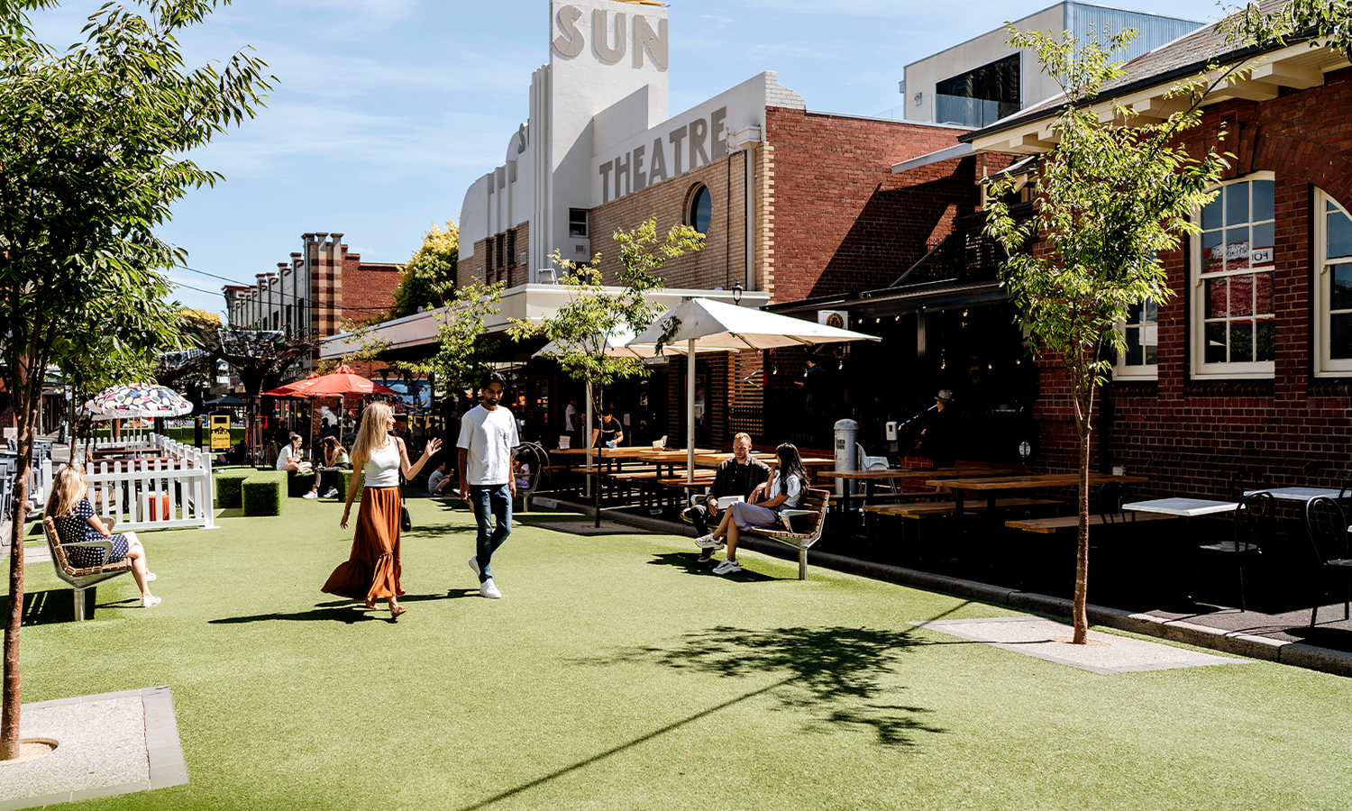
Streets that give high priority to walking, cycling and facilitating social contact, while allowing for low-speed motor vehicle traffic. They are usually in areas of concentrated activity.
Pedestrian priority streets give high priority to walking and cycling, while allowing low-speed motor vehicle traffic (under 40km per hour). These streets are usually found in areas of intense and diverse activity such as activity centres, education facilities and public transport interchanges.
They accommodate diverse travel modes as well as provide a public space function. Bicycle lanes may either be provided as a separate lane, or a shared path with other modes. Streets may also restrict vehicle types or access at times.
Pedestrian priority streets perform many functions. They are comfortable and safe for all pedestrians, including those with a disability, and provide a safe environment for low-speed cycling. They can also be the setting for informal activity such as performers and vendors. Well-designed pedestrian priority streets encourage walking and cycling. Higher pedestrian numbers support the viability of nearby businesses, and allow uses such as cafes and restaurants to 'spill out' on to the street.
Element 2.1 Movement network principles
Paths that provide for people moving on foot, bicycle or other mobility aid vehicles within streets or public and semi-public spaces.
Pedestrian and bicycle paths specifically provide for people on foot, bicycle or other mobility aid vehicles. Paths may be located on local streets and major roads, in public spaces such as parks and reserves, or through semi-private spaces such as car parking lots, forecourts and arcades. Paths may be solely for pedestrian use, cyclist use, or shared paths for pedestrians and cyclists.
Pedestrian and bicycle routes should connect people directly with local destinations such as schools, shops, train stations and parks.
Convenient, safe and comfortable pedestrian and bicycle paths are a valuable part of the movement network, and act as more than just thoroughfares. Footpaths are multi-use environments where people socialise, conduct business and observe the world around them as well as travel from one place to another on foot. Pedestrian and bicycle paths are also very important in enabling people to be physically active.
Pedestrian and bicycle paths are most inviting when they are direct, highly visible and well sign-posted, offer shade, seating and end-of journey facilities. The diverse needs of pedestrians and cyclists – children and young people, older people and those with a disability who may be using mobility aids – require inclusive design solutions..
Element 2.1 Movement network principles
Element 2.4 Pedestrian and bicycle crossings
Austroads 'Guide to Road Design' provides technical guidance for path design.
In designing a path, consider the functions the path will perform and the variety of people who may use it, including people with wheelchairs or prams.
Vehicle crossovers and entries to laneways can pose a risk to pedestrians and cyclists, both as trip hazards and vehicle collision hazards. For the design of vehicle exits from buildings see Element 5.4 Car parking structures, and for car parking lots see Element 2.8 Car parking lots.
The parts of the movement network that allow pedestrians and cyclists to safely cross roads and other barriers.
Pedestrian and bicycle crossings provide points to safely and conveniently cross roads and streets, or other barriers such as motorways, railway lines or waterways. Many crossings are located on paths to activity centres and schools, or at stations, bus or tram stops.
Crossings are either at-grade or grade-separated. At-grade crossings may have road markings and surface treatments, traffic signals and signs, or barrier gates. Grade-separated crossings include pedestrian bridges, overpasses, subway underpasses, or stairs and lifts.
Pedestrian and bicycle crossings are critical for safe, easy movement around cities and towns. Crossings concentrate pedestrian and cyclist movement to specific locations where they can safely cross the road or barrier. Where crossings are poorly located, say away from movement desire-lines, or with interrupted sightlines to the approaches or crossing, it may be perceived as an inconvenience or safety risk, and not be used.
Element 2.1 Movement network principles
Element 2.3 Pedestrian and bicycle paths
Austroads Guide to Road Design provides technical guidance for crossing design.
Grade-separated crossings, while safer than at-grade crossings, can involve longer travel distances and crossing times so that pedestrians and cyclists might choose not to use them, and to cross barriers informally at risk to themselves and others.
The pedestrian and bicycle paths adjacent to roads with high volume, high-speed vehicle traffic.
Major roads accommodate high volumes of motor vehicle traffic including public transport and freight, and have higher design speeds (60–100 km/h). Major roads can have two or more traffic lanes in each direction and may provide for on-street car parking, bus lanes or tram tracks, bicycle lanes, as well as verge space for pedestrian paths, infrastructure and landscaping.
Major roads may be identified as priority routes for public transport, motor vehicle traffic or freight. Larger major roads that are declared arterial roads are managed by VicRoads. Pedestrians and cyclists, while accommodated on these roads, may be given a lower priority in terms of access and amenity while maintaining a high level of safety. A section of an arterial road through an activity centre or school zone may have lowered design speeds.
Major roads carry large volumes of people and goods over longer distances. While they provide connections between major centres of population, regions and transport terminals, they also function as local area connections for all modes. Major roads sometimes lie within centres of high activity, where they may function as pedestrian priority routes to pedestrian priority places with periods of lowered traffic speed limits for a section of their length.
This element focuses on safe and convenient travel for pedestrians and cyclists on major roads.
This element does not cover design of motorways and railways.
Element 2.1 Movement network principles
Element 2.3 Pedestrian and bicycle paths
VicRoads is a referral authority for all landscape treatments and works adjacent to arterial roads.
The stops and access routes to trams and buses.
There are two main types of public transport that use the road network: the fixed tram network, which is usually located on major roads and streets; and the bus network, which operates within standard traffic lanes or in bus priority lanes. Bus and tram priority routes have priority over general traffic.
Public transport on roads helps move large numbers of people around a city, taking them to work, school, shopping or other activities.
This sub-element focuses on providing people with convenient access to public transport on roads. The engineering, servicing or management issues of the public transport are guided by other appropriate authorities. See also Public Transport Guidelines for Land Use and Development (Department of Transport 2008) and also Guideline sources and references for a list of technical guidance.
Public transport stops may be located on the road, kerbside or on centre road refuges.
Convenient, commercial vehicle and casual car parking close to local destinations.
On-street car parking is part of the movement network. On-street parking provides convenient, short-term parking in close proximity to activities and destinations. On-street parking may be parallel, indented, angled, at kerbside or in centre-road islands. The street type and use pattern determines the appropriate type of on-street parking used.
It plays an important role in inner urban areas with limited off-street parking. The presence of on-street parking can affect driver behaviour by reducing vehicle speeds. Parking manoeuvres can interrupt and calm traffic flow, providing additional opportunities for pedestrians to cross a road. The presence of parked cars can make a street feel more inhabited. Well-managed on-street parking can provide a good service with a minimal number of car parking spaces.
The civil design of on-street parking is guided by Australian Standard AS 2890.5 – 1993, Parking Facilities Part 5: On-street Parking.
Managing the use of on-street parking spaces is fundamental to on-street parking provision. Some methods to ensure regular turnover of parking spaces are controlling the parking period; parking permits; parking charges; or clearways periods. Some on-street parking spaces can also be converted to bicycle parking as demand increases.
Open areas of land used for parking cars.
Car parking lots are open areas of land used for parking cars. They can be publicly or privately owned and are generally located in activity centres,at train and bus stations, and other facilities accessed by car. Some higher density residential developments may incorporate private car parking lots.
While many car parking lots are open to pedestrian access, dedicated pedestrian paths are not common. Bicycle movement through car parking lots is generally restricted or not permitted. At times, car parking lots may be used for other purposes, such as a market, or for entertainment or sports activities.
Car parking lots are important for the convenience of drivers and the viability of some businesses, and in activity centres they provide space for customer parking away from neighbouring residential streets. Where land is freely available and land values are relatively low, car parking lots are often the least costly method of providing parking in urban areas.
Car parking lots should be convenient, pleasant and safe for users. As they occupy large areas of land they should be designed not to create barriers for pedestrians. Measures should be taken to minimise the impact of paved surfaces in radiating heat in summer and generating stormwater run-off. After hours and during low demand periods, car parking lots should be managed to ensure they do not attract anti-social behaviour and are safe for users.
Pedestrians will look for the most direct route to their destination. This preferred direct route, called a desire-line, may cross vehicle lanes and garden beds, putting pedestrians at risk and damaging landscaping.
Guidelines